Here Are At Least 6 Shipwrecks You Can Paddle To in West Michigan
If you find yourself fascinated by shipwrecks, it may surprise you to learn just how many shipwrecks you can find around Michigan. Lake Michigan, alone, is said to be the final resting place of at least 1,500 shipwrecks with many dating back to the 1800s. Read more here.
The great news is there are a number of shipwrecks along Michigan's coast and even in some of Michigan's smaller channels that can be visited by paddle boat. The website storymaps.com lays out all of Michigan's shipwrecks and lists them by difficulty and whether or not they can be reached by paddle boat. Here's the only con: the provided interactive map only uses latitude and longitude coordinates to identify the shipwreck. There are no town names, state park names, lake names, or anything else that would guide a novice paddle boater to the right location. See the map here.
With that being said, if you're in the mood to explore, here are at least 6 shipwrecks along West Michigan's coast that you can visit by kayak, canoe, or paddleboard:
1. The Novadoc
The Novadoc was a steel bulk freighter that was lost during a storm in November of 1940. The Armistice Day storm to be exact. She currently lies in about 12 - 15 feet of water off the coast of Pentwater. See a full exploration of this ship below:
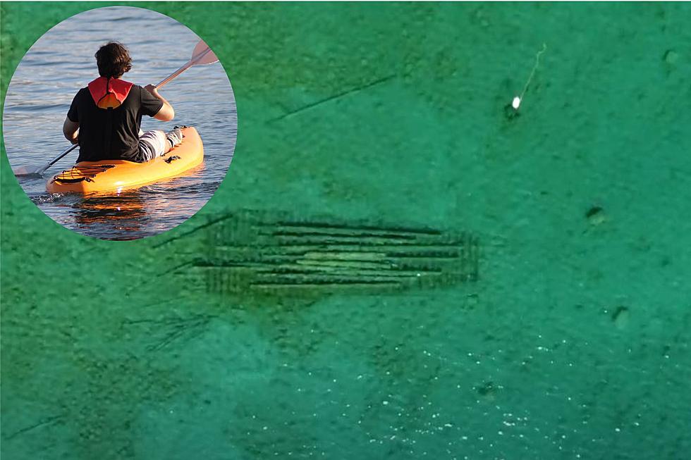
2. Daisy Day
The Daisy Day was a wooden freighter built around 1880. She didn't have a long life span, though, as she was lost in 1891 in the shallow water off the coast of Claybanks Township Park. She currently rests in about 10 feet of water which can be accessed by paddle boat.
3. The Henry Cort
The Henry Cort had a rather eventful lifespan before she sank off the coast of Muskegon. Built in the late 1800s, she had sunk/wound up stranded two separate times before encountering a storm that ran her into the rocks on the north side of the Muskegon Channel. She currently sits in about 12-15 feet of water.
4. The Interlaken
The Interlaken, originally designed as a construction barge in 1893, was lost off the coast of Michigan just north of the Montague area in 1934 after becoming stranded during a storm. She was actually discovered by a father/son duo in 2005 and currently sits in about 15 feet of water mostly covered by sand.
5. The Helen
The Helen was constructed in 1881 and was designed to be able to traverse shallow waters. However, a heavy storm in November of 1886 overwhelmed The Helen taking her captain with her along with 5 other crewmen. Present-day, she sits in 10 feet of water with her visibility varying thanks to shifting sands.

6. The Manistee
The Manistee was a steamer built in Benton Harbor in 1882 and could carry around 500 passengers. With a ship that size, it might surprise those that live around the Ferrysburg area that this ship currently sits right off the shore of some of their homes. The ship, while at dock, caught fire in 1914 and now rests in about 25 feet of water in Spring Lake.
And those are just 6 of the many shipwrecks around the state of Michigan that you can access by kayak (or other paddle boats). See the full interactive map here.
If you're more of a "yeah, I'll explore shipwrecks from the comfort of my couch" kind of person, check out this quick tour of the Albany Shipwreck in Michigan:
In fact, there's a photographer who spends his time exploring these shipwrecks so you don't have to. See more from Chris Roxburgh below:
Exploring The "Upper Canada" Ghost Ship on the Black River
5G Towers in the Kalamazoo Area
More From WKMI