VIDEO: Powerful Storms Move Through Battle Creek
Powerful storms brought strong winds, torrential rain, hail, and power outages to Battle Creek on Wednesday.
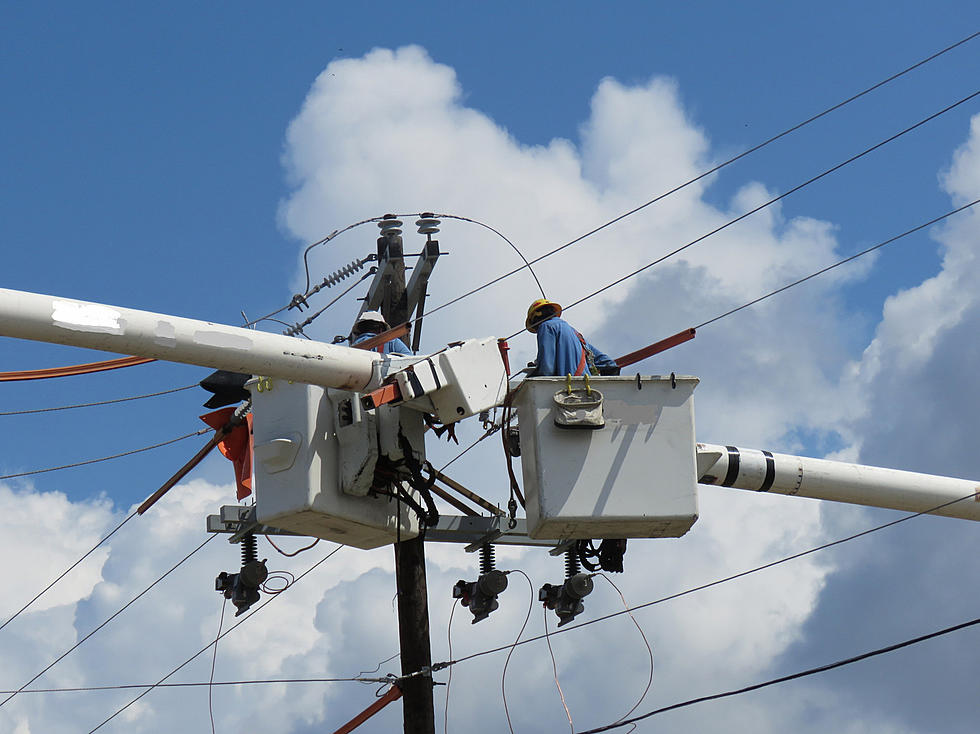
The tropical storm that made landfall at the Gulf of Mexico last weekend was still going strong as what was left reached southern Michigan overnight Tuesday into Wednesday. Consumers Energy reported more than 34 thousand were without power Wednesday morning. Crews were scattered all across the region working to get over 750 separate outage areas back in service. Indiana Michigan and DTE also reported thousands without service from the storms. For the first time in recorded history, a tropical depression will advance as far north as Lake Superior with Cristobel expected to cross that body of water today. Much of Michigan was either at an Enhanced Risk or Moderate Risk for severe weather Wednesday.
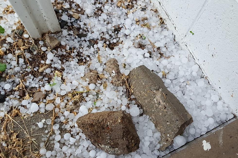
Around 2:30 p.m. Wednesday, June 10, the system produced a storm with winds and rains so powerful visibility was less than a quarter-mile in Battle Creek. Hail larger than a quarter laid across open areas.
Emmett Township and Bellevue were hit particularly hard downed powerlines, downed trees, and power outages.
Disclaimer: Do not attempt at home. The individual that filmed the storm is a Trained Weather Spotter.
Before the afternoon storm, temperatures were at a very humid 85 degrees in Battle Creek. Within 10-15 minutes, temperatures plummeted by 18 degrees to 67. As the winds battered the city, the power blinked off and on throughout the area before finally going dark.

SEE MORE: 10 Signs To Look For When Watching For A Tornado
More From WKMI